


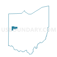
JACKSON Voting District, Auglaize County, Ohio
About
Outline

Summary
| Unique Area Identifier | 642871 |
| Name | JACKSON Voting District |
| County | Auglaize County |
| State | Ohio |
| Area (square miles) | 18.14 |
| Land Area (square miles) | 18.14 |
| Water Area (square miles) | 0.00 |
| % of Land Area | 99.98 |
| % of Water Area | 0.02 |
| Latitude of the Internal Point | 40.39950290 |
| Longtitude of the Internal Point | -84.40159510 |
Maps


Graphs
Select a template below for downloading or customizing gragh for JACKSON Voting District, Auglaize County, Ohio


Neighbors
Neighoring Voting District (by Name) Neighboring Voting District on the Map
- GERMAN Voting District, Auglaize County, OH
- MARION EAST Voting District, Mercer County, OH
- MCLEAN Voting District, Shelby County, OH
- MINSTER N Voting District, Auglaize County, OH
- MINSTER S Voting District, Auglaize County, OH
- NEW BREMEN E Voting District, Auglaize County, OH
- NEW BREMEN W Voting District, Auglaize County, OH
Top 10 Neighboring County Subdivision (by Population) Neighboring County Subdivision on the Map
- German township, Auglaize County, OH (3,748)
- Jackson township, Auglaize County, OH (3,649)
- McLean township, Shelby County, OH (3,245)
- Marion township, Mercer County, OH (2,970)
Top 10 Neighboring Place (by Population) Neighboring Place on the Map
Top 10 Neighboring Unified School District (by Population) Neighboring Unified School District on the Map
- New Bremen Local School District, OH (4,641)
- Minster Local School District, OH (4,237)
- Fort Loramie Local School District, OH (3,917)
- Marion Local School District, OH (3,717)
Top 10 Neighboring State Legislative District Lower Chamber (by Population) Neighboring State Legislative District Lower Chamber on the Map
Top 10 Neighboring State Legislative District Upper Chamber (by Population) Neighboring State Legislative District Upper Chamber on the Map
Top 10 Neighboring 111th Congressional District (by Population) Neighboring 111th Congressional District on the Map
Top 10 Neighboring Census Tract (by Population) Neighboring Census Tract on the Map
- Census Tract 9679, Mercer County, OH (6,825)
- Census Tract 9715, Shelby County, OH (5,222)
- Census Tract 9716, Shelby County, OH (4,907)
- Census Tract 409, Auglaize County, OH (3,748)
- Census Tract 410, Auglaize County, OH (3,649)